120.21 - Map of the States of Virginia, and Maryland, 1831, by History & Topography of the United States, publication
$180.00
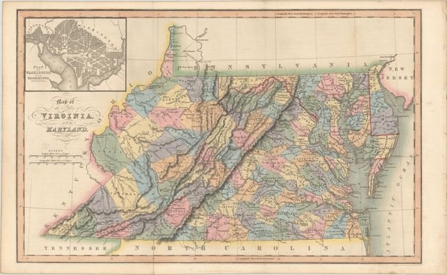
A detailed map of Virginia, Maryland and Delaware providing good topographical features of the region. Shown are settlements, buildings, roadways, and the Appalachian Mountain range. Includes an insert in the upper left corner of the plan for the City of Washington and Georgetown. The map is rated Excellent [see our rating criteria on the Home page] with slight age toning and fold marks (as issued). It measures approximately ( 15.5″ x 9.8″ – 39.4 x 24.9 cm).
($12.00 shipping / handling / ins. - foreign postage addnl.)