520.28 - Carte pour l’lntroduction a l’Historie d’Angleteterre, ou l’on Voit son Premier Gouvernementm et l’Etat Abrege de Cette Monarchie sous les Empereurs Romains, et sous les Rols Saxons, ca 1715, by Henry Abraham Chatelain, Amsterdam
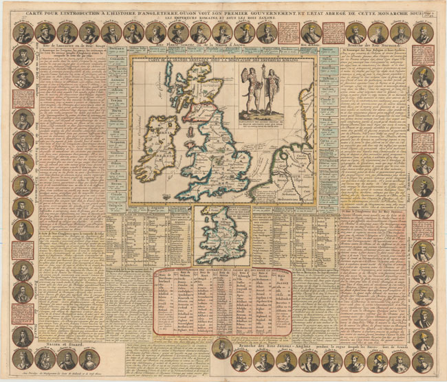
From the Atlas Historique this is an intriguing cartographic rendering. Depicting Britain under Roman rule, the map with abundant text about the history of Britain, including tables, concerning the kings, states and villages of the kingdom. Included is a small map of England and Wales in the center showing the Anglo-Saxon realm. To the right side of the map there is a figure of a male and female in attire of the time of Caesar’s conquest of Britain. The border of the sheet features 54 medallion portraits depicting the royalty of Britain from the time of Egbert (801) to Queen Anne (1701). The map is rated Excellent [see our rating criteria on the Home Page] in original color with several professional repairs to two minor separations at the fold marks. It measurers approximately ( 25.5″ x 20.3″ – 59.7 x 51.6 cm).