520.29 - Tabula Geographica Campaniae Specialis in Suas sic Dictas Electiones Accurate Distincta, ca 1750, by Johann Baptist Homann, Nuremberg
$310.00 -
(Zoom image – Hover slowly over image to see detail)
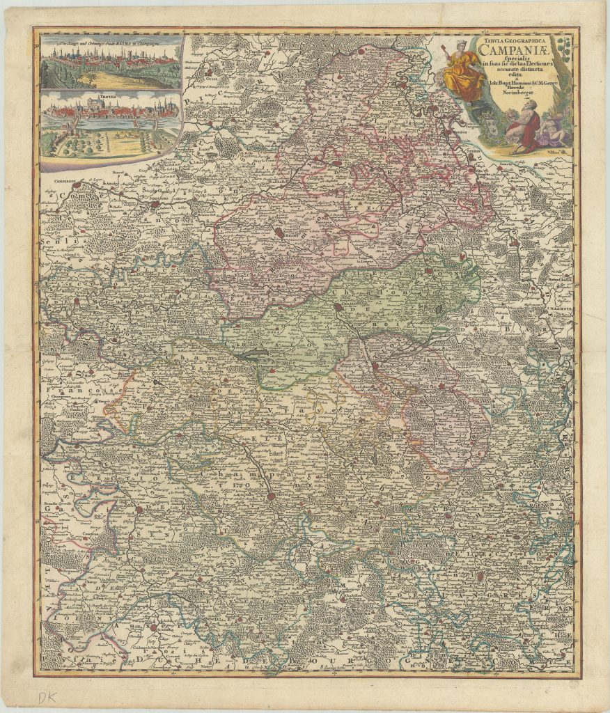
Beautifully detailed map of the Champagne region of France, illustrating the topography and towns of Compiegne, Menziere and Reims in the north to Sens, Trpyes and Langres in the south. The insert at the top left depicts bird’s eye views of Troyes and Reims. A beautiful title cartouche in the upper right features two satyrs imbibing in champagne. The map is rated Excellent [see our rating criteria on the Home Page] with a crisp impression and contemporary full color; with later color in the cartouche and views. Several separations are noted, professional repairs made along the centerfold and two minor edge tears noted. The map measures approximately 19.4″ x 22.9″ – 49.3 x 58.2 cm).
($12.00 shipping / handling / ins. - foreign postage addnl.)