120.60 - Map of the Country between Monterey and Corinth, Miss., Maj Gen Halleck; 1875, by Krebs Lithographing Company, Cincinnati
$40.00
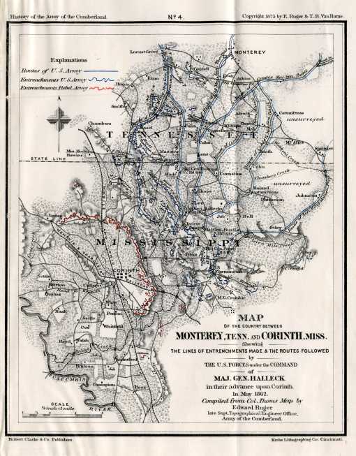
The map is from the publication Van Horne’s History of the Army of the Cumberland prepared by Edward Ruger illustrating the various Civil War battles in Tennessee. Ruger was employed by the U. S. Topographical Engineers and had access to the War Department maps and plans which aided in the finely engraved and very detailed battle plans. Union and Confederate forces are shown in color with troop movements and commanding officers of both sides noted. The map is rated Excellent, with no apparent flaws and measures approximately (6.5″ x 8.1″).
($9.00 shipping / handling / ins. - foreign postage addnl.)