Europe - Victor Levasseur
Rare Old & Antique Maps for Sale.
570.14 Atlas National Ilustre’ Departments….de la France (1845- 1864) by Victor Levasseur, Cartographer
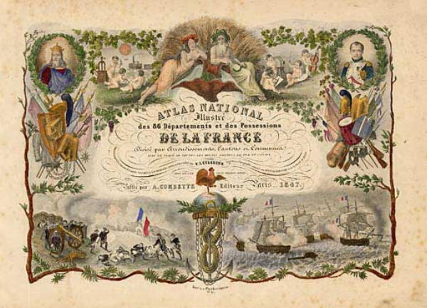
The Atlas National Ilustre’ des 86 Departments et des Possessions De La France was produced by Victor Levasseur a 19th century cartographer who distinguished himself with striking embellishments surrounding the maps of the ‘departments’ of France. These illustrations included scene of French history, countryside, products (particularly those areas of France bearing the names of some of the world’s finest wines), and other related activities indigenous to each department. Each print offered is a dark impression finely engraved and printed on heavy paper. Each print measures approximately [12.1″ x 17.1″] accompanied with a Certificate of Authenticity inscribed with the purchasers name and country. Each print is priced at $65. USD. Shipping and handling cost within the continental U.S. is $12.00 for up to 6 maps purchased at the same time. All the maps offered in this series are rated Very Good. Please see the rating criteria on the Home Page for full explanation. Many of the maps are in either outline or full body color. Listed below are the maps available:
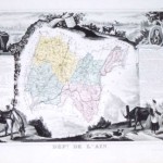
The map includes part of the French Alps. The city of Bourg is near the center. The production of cheese, in including Bleu de Gex is a leading product of…
Read More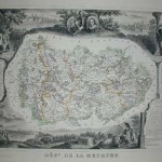
The map depicts the region of France that produces fine Gruyere cheeses. Includes scenic areas of the Alps. Condition is Very Good [see rating criteria – Home Page].
Read More
A very detailed map of this French region with representation of the framing and indigenous animals as well as textual data.
Read More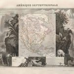
This beautifully engraved map is one of the more sought-after issues by Levasseur. It shows North America with the Republic of Texas named within Mexico and the northern U.S. border…
Read More