22.14 - Plan der stadt van Quesnoy [France], c1729, Anonymous
$190.00
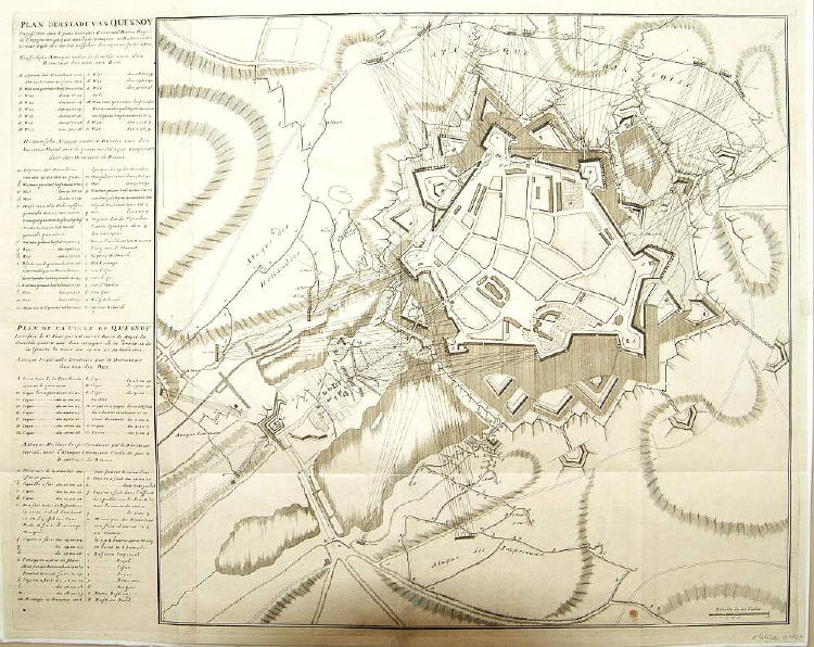
A very detailed battle map of the siege of Quesnoy, France by the Dutch on June 20, 1712. The birds-eye-view of the battle includes artillery tracks of the Dutch forces as well as a key to the left of the print of the fortifications, etc. printed in both French and Dutch. The map is rated Very Good [see our rating criteria on the Home Page]; printed in two sheets joined to form a large view of the print is uncolored and measures approximately (21.5″ x 27.3″) accompanied by a certificate of authenticity.
($12.00 shipping / handling / ins. - foreign postage addnl.)