368.23 - Plan of Boston, 1878, by S. Augustus Mitchell, Philadelphia
$180.00
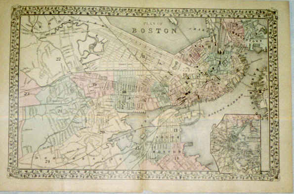
This is the large plan of the city by Mitchell from his Atlas of the World. The map shows the districts by number an pastel color and includes an insert – Map of the Country around Boston showing also its Harbor & Islands. The map is rated Very Good and measures approximately (20.8″ x 13.6″).
($12.00 shipping / handling / ins. - foreign postage addnl.)