570.194 - Amerique Septentrionale, 1845, by Victor Levasseur, Paris
$300.00
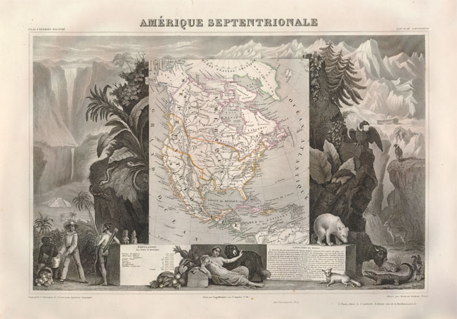
This beautifully engraved map is one of the more sought-after issues by Levasseur. It shows North America with the Republic of Texas named within Mexico and the northern U.S. border extending into the present-day Canada. Alaska is depicted as belonging to Russia. Typical of the Levasseur maps are the beautifully depicted indigenous animals of the region as well a ship that appears stranded in the polar sea as well as a Mayan temple. The map is rated Excellent [see our rating criteria on the Home Page] with original outline color, full image color noted. The map measures approximately (17.0″ x 11.1″ – 43.2 x 28.1 cm).
($12.00 shipping / handling / ins. - foreign postage addnl.)