570.23 - Poliometria Europae Maxime Autem Germaniae ac Finitimorum Locorum. Altkolorierte Kupfertafel von Elwe, ca 1792 by Jan Barend Elwe, Amsterdam
$138.00
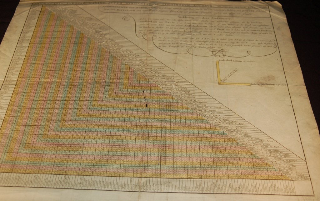
An unusual thematic chart which depicts the traveling distances from various European cities. The very detailed text and graphic arrangement is still used today with many travel guides The design shows distances from key cities such as Paris and Amsterdam to smaller locations in Europe. The hand colored chart is rated Good (see our rating criteria on the Home page) with several tears noted and two small (less than 1 cm) lose of paper near the centerfold affecting travel distances of several locations. Printed on heavy paper with some reenforcements on the verso. The chart measures approximately ( 23.2 “ x 20.5″ – 50.1 x 58.2 cm).
($12.00 shipping / handling / ins. - foreign postage addnl.)