70.03 - Navigation Computer, ca 1951, by U. S. Coast & Geodetic Survey, Washington, D.C.
$40.00
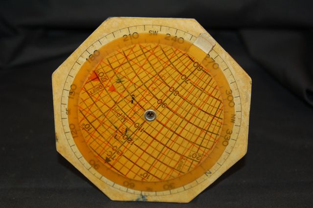
This instrument was used to scale distances on aeronautical charts in the 1950’s. It would also calculate air speeds based on miles as shown on the verso of the scale. The instrument measures approximately (4.5″ in diameter – hexagon shape) with movable rotating wheel on the front and verso.
($9.00 shipping / handling / ins. - foreign postage addnl.)