700.07 - Carte de l’Ocean Occidental Dressee pour Servir a l’Histoire Generale des Voyages, 1746, by Jacques Nicolas Bellin, Paris
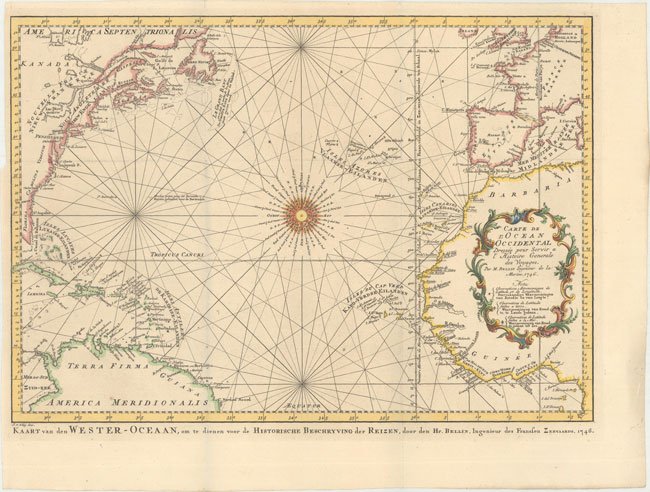
This is the Dutch edition (Van Schley) depicting the Atlantic Ocean. The chart is one of the earliest editions of the Atlantic basin that displays accurate information in beautiful detail taken from Bellin’s magnificent sea atlas Hydrographe francaise (1753). The chart is centered on a 32-point compass rose and delineated with rhumb lines. The geography includes a significant portion of North America from the colonies of Florida, Carolinas, Virginie, Penslivanie and Nouve to Angleterre, Ne. Ecosse and beyond. The effort made for this publication, under the auspices of the French Depot de la Marine; is the first publication of its type by a government organization to chart the worlds oceans. Of note is the Prime Meridian through l. Ferro with an alternate Prime Meridian through Paris. The chart is rated Excellent [see our rating criteria on the Home Page] with a dark impression on watermarked paper and Dutch text below the bottom neatline. The issue measures approximately (17.6″ x 12.4″ – 43.7 x 31.4 cm).