700.08 - Planisphere Physique Ou l’n Voit du Pole Septentrional ce que l’on Connoit de Terres et de Mers .... ca 1750, by Philippe Buache / J. A. Dezauche, Paris
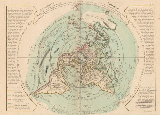
This rare copy of an unusual thematic map taken from the collection of Philippe Buache’s whose maps were purchased by J. A. Dezauche after Buache’s death; illustrates on a polar projection, various types of information. The track lines of noted explorers including Tasman, Halley, and Magellan are depicted. Color coding identifies which landmasses drain into various bodies of water around the globe. The inland detail is confined to rivers and mountain ranges with specific hachures. Noted in North America is the Sea of the West and the Northwest Passage enigma . Printed on watermarked heavy paper, the map is in original color, is rated Very Good [see our rating criteria on the Home Page] with some extraneous ink marks noted in the image and light foxing; mainly in the large blank margins. The map measures approximately ( 17.3″ x 13.5″ – 44.0 x 34.3 cm).