800.04 - Carte de la Barbarie le la Nigritie et de la Guinee...., c1792, by Guillaume de L'Isle, Paris
$439.00
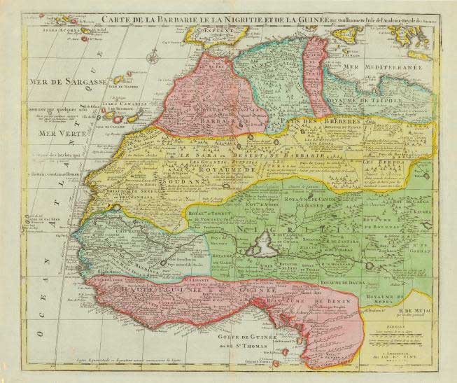
A beautiful 18th century map of northwestern Africa from Barbary, Nigeria and Guinea to below the equator. The map is full of geographic names and details with information on rivers and lakes of the continent. This map first appeared in De L’Isle’s Atlas de Geographie (1700-1712) and was later re-issued by Jan Elwe. Numerous encampments are depicted with great detail throughout the Sahara Desert. The map is rated Very Good with only slight age toning at the centerfold [see our rating criteria on the Home Page] and measures approximately (22.5″ x 19.4″) with a Certificate of Authenticity.
($12.00 shipping / handling / ins. - foreign postage addnl.)