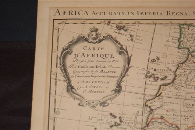
800.09 - Afrique ... Dressee pour l’usage du Roy par Guillaume, DeLisle, Premier Geographe de Sa Magjeste de l’Academie Royale des Sciences, ca 1742, by Covens & Mortier, Amsterdam
$795.00
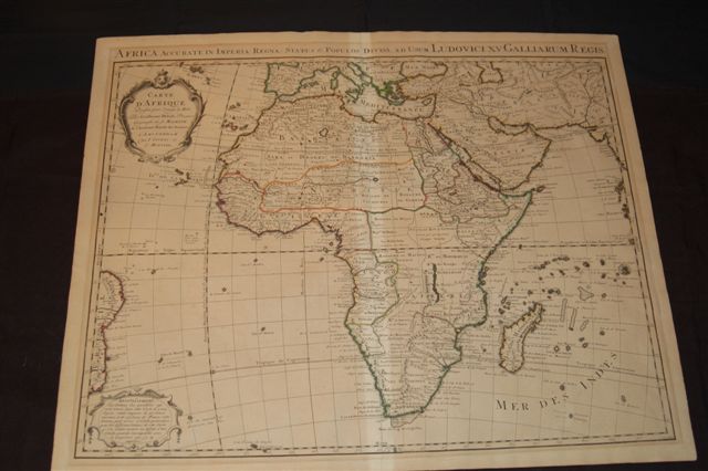
This is the third edition of this beautiful and very detailed map of Africa during the middle of the 18th century. It is an important map of the continent and Madagascar. The map is from de Lisle’s atlas of 1722 and then revised by Covens and Mortier. Above the neatline in Latin a sub-title appears “ Africa accurtae in imperia, regna, status & populous divisa, ad usum Ludovici XV, Galliarum Regis”. The map is rated Very Good , printed on heavy paper in original outline color with only light foxing noted and some light toning seen at the centerfold due to archival tape applied on the verso to re-enforce the fold [see our rating criteria on the Home Page]. It measures approximately (19.5″ x 24.5″ – 49 x 62 cm).
($12.00 shipping / handling / ins. - foreign postage addnl.)