801.110 - City of Honolulu, WWII, 1944, by U.S. Corps of Engineers, Washington, D.C.
$210.00
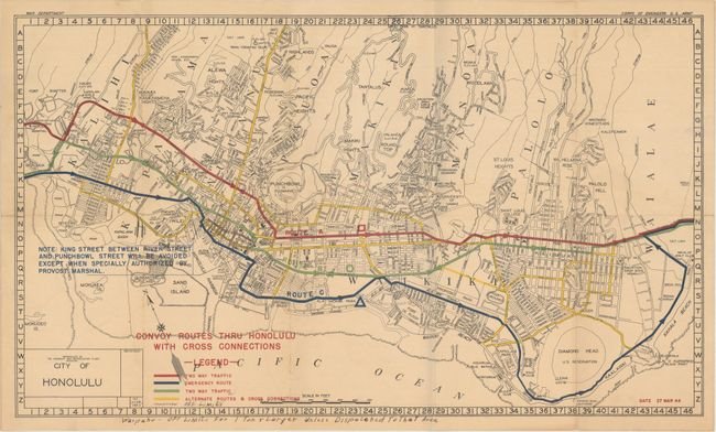
A very detailed map of the city that was issued in 1944 to show “two-way traffic, emergency routes, and alternate routes”. Off-limit areas, which were subsequently added to the printed 1945 version. This unusual offering includes manuscript notations in the legend and in the bottom blank margin of the map. It measures approximately (27.4″ x 16.0″ – 69.6 x 40.6 cm). The condition is rated Excellent [see our rating criteria on the Home Page]. Folded as issued with light toning noted.
($12.00 shipping / handling / ins. - foreign postage addnl.)