120.02 - Der Seeboden - Der Seeboden Long Island - Der seeboden Florida und Cuba, dated 1870, by Justus Perthes, Gotha
$180.00
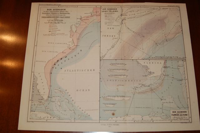
A sheet containing three maps to include the East Coast of the United States from Massachusetts to Florida and depicting the Gulf Stream. The second map shows Long Island and the coast of New Jersey with the Gulf Stream and underwater data. The third map shows the Florida Straits as well as the bottom configuration of the Florida Keys, Salt Key Bank as well as other hydrographic features. The map in color was taken from the Geographische Mittheihmgen. The maps condition is rated Very Good [see our rating criteria on the Home Page] with only minor foxing noted. It measures approximately (12.0 ” x 9.1″ – 30.5 x 24.5 cm).
($12.00 shipping / handling / ins. - foreign postage addnl.)