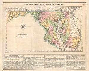
120.04 - Geographical, Statistical, and Historical Map of Maryland, 1822, from - A Complete Historical, Chronological, and Geographical American Atlas, Philadelphia
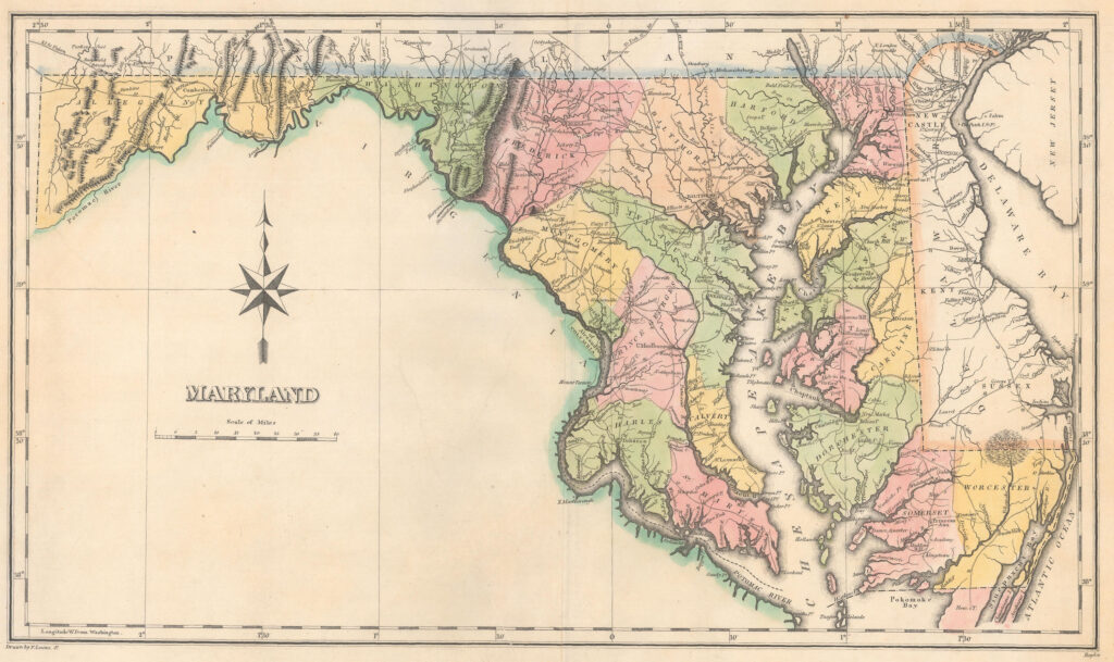
The map is on a full sheet (20.6″ x 16.5″) with text below describing boundaries, principal towns, cities, climate, and other geographic detail. Maryland counties are shown in color. Rivers and roadways with interesting details of battlefields of the War of 1812. Portrayed are the engagements at Bladensburg, Frenchtown, and near Baltimore. Washington, D.C. is prominently displayed , with Georgetown and the capital noted within its borders. Delaware and parts of Pennsylvania are shown, without color. Embellishments include an incredibly detailed compass rose. The map was drawn by Fielding Lucas, Jr. and engraved by Boyd. It is rated Excellent [see our rating criteria on the Home Page] with professional repairs noted along the lower border and centerfold separation near the bottom. It measures approximately (19.1″ x 11.1″ – 48.5 x 28.2 cm).