120.06 - Carte du Paraguai, du Chili, du Detroit de Magellan &c. Dressee sure les Memoires les Plus Nouveaux & les Observations les Plus Exactes, ca 1720 by Henri Abraham Chatelain, London
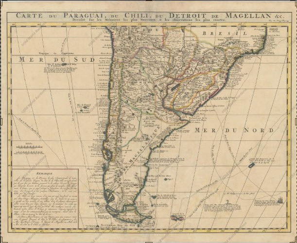
A large, finely engraved map of the southern part of South America with good topographic detail and place names throughout the map. Included are track lines of several explorations including Amerigo Vespucci’s ship sailing in the Atlantic. There is a depiction of water fowl noted in the ocean areas; as well as animals in the arctic waters. The depiction shows “half bird” and “half fish” in the notations. Henri Chatelain published a number of mapping issues including the Atlas Historique … in 1705 – 1735. The print is rated Excellent [see our rating criteria on the Home Page] good impression on watermarked paper, some age toning seen. A separation is noted with professionally archivally closures. The map measures approximately (20.2″ x 15.8″ – 51.3 x 40.1 cm).