120.13 - Yucatan Conventus luridici Hispaniae Novae pars Occidentalis, et Guatimala Conventus luridicus, ca 1671, Arnoldus Montanus, Amsterdam /John Ogilby, London
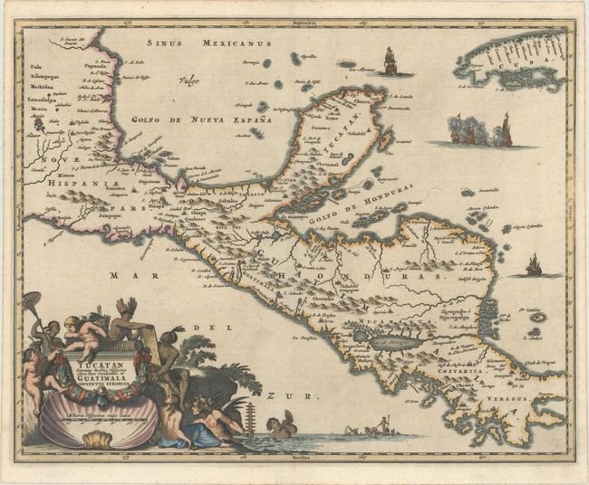
Arnoldus Montanus (1625 – 1683) produced one of the greatest illustrated books on the Americas De Nieuwe en Onbekende Wereld, 1671. There were one hundred beautifully engraved plates, views, and maps of North and South America. The plates vividly depict forts, festivals, occupations, sailing ships, battles, and native inhabitants. This map was used by John Ogilby (1600- 1676) an accomplished geographer, dancing master, poet, historian, printer, publisher – Royal Cosmographer (1671) in his work, Complete History of America. This very decorative map offered here, covers the region from Mexico City to Panama City and extends to include part of Cuba. Cozumel is named, and Lake Nicaragua is shown on an east-west orientation. A very detailed hand colored title cartouche vividly depicts this part of Central America and the Yucatan. The map is rated Excellent [see our rating criteria on the Home Page]. A dark impression on a sheet with a jester watermark. Some light toning is noted. The map measurers approximately (14.3″ x 11.3″ – 36.3 x 28.7 cm).