22.18 - City of Roan, France, c1575, by George Braum / Frans Hogenberg, Cologne
$350.00
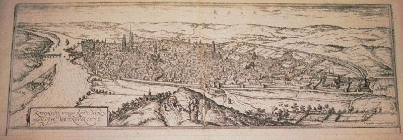
A detailed panoramic view of Roan, France giving great detail of the buildings and countryside from the joint publication by Braum / Hogenberg the Civitates Orbis Terrarum 1572- 90. The publication reflects the vast amount of information Braum collected for over 500 European city plans / views / maps published in six volumes between 1572 and 1617. Most of the engravings were made by Simon Novellanus and Frans Hogenberg. The print is rated Very Good [see our rating criteria on the Home Page] with the print cut close to the neatline and measures approximately (5.1″ x 18.8″) accompanied by a Certificate of Authenticity.
($12.00 shipping / handling / ins. - foreign postage addnl.)