362.24 - Portland Harbor, Maine, 1866, by the Survey of the Coast, Washington, D.C.
$130.00
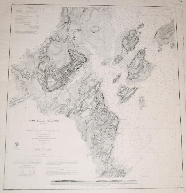
The first published nautical chart by the Survey of the Coast (U.S. Coast Survey) to include both hydrographic and topographic information. In addition to the soundings in the harbor there are roads, buildings and waterways depicted. There is a headland view of Portland Harbor illustrating the entrance and showing the Head Light and the Observatory on Monjoy’s Hill. The chart is at a scale of 1:20,000 providing great detail of all data. The print is a direct impression taken from the original copperplate engraving of 1866 . Printed on heavy chart paper the impression was made in 1976. It measures approximately (27.1″ x 30.0″ – 71.5 x 75.5 cm).
($12.00 shipping / handling / ins. - foreign postage addnl.)