368.25 - Johnson's California and the Territories of New Mexico, Arizona, Colorado, Nevada and Utah, 1864, by Johnson & Ward, Philadelphia
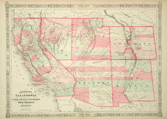
In 1863 Alvin J. Johnson and Benjamin P. Ward formed the next generation of the Johnson mapping business. Ward was an agent for the Johnson company and when Johnson’s former partner, Browning left the company; Ward was elevated to full partner with mainly duties in the field, marketing their maps and atlases. This map is from their Family Atlas. The map is embellished with interesting printed notations about the Indian tribes of the great southwest. Mail routes of the Pony Express are shown as well as military forts and trails. The map is rated Very Good [see our rating criteria on the Home Page] was several repairs noted at the maps left edge and a centerfold tear that has been repaired with archival tape. The map measures approximately (17.6″ x 25.1″).