400.37 - Description, Situation & Vue de la Ville de Mexique des Deux Lacs sur lesquels ele est Batie, du Grand Temple de Cette Ville, des Sacrifice d'Homme qu' on y Faisoit, de l' Idole des Mexicans... c 1719, by Henry Abraham Chatelain, Amsterdam
$320.00
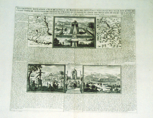
An unusual folio sheet with French text, two maps and four views. The Carte du Mexique shows Central Mexico and the Environs du Lac de Mexique highlighting the area near Mexico City to include the islands with the connecting bridges. The four views include a panoramic scene of Mexico City. Another of the Aztec Temple, and two showing various ceremonies including human sacrifice. The sheet is rated Very Good [see our rating criteria on the Home Page] with no apparent flaws and measures approximately (17.2″ x 14.5″).
($6.00 shipping / handling / ins. - foreign postage addnl.)