520.15 - Insulae Danicae in Mari Balthico Sitae, Utpote Zeelandia, Fionia, Langelandia, Lalandia, Falstria, Fembria Mona, Repraesentatae, ca 1730 by Johann Baptist Homann, Nuremberg
$320.00
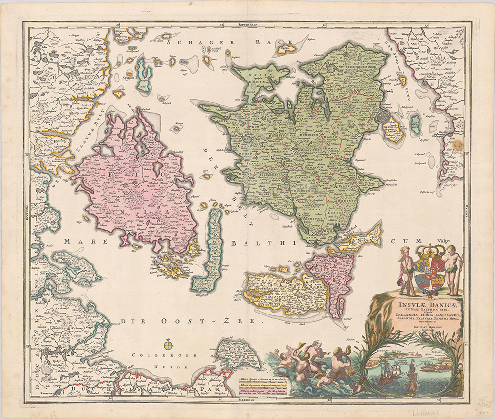
A beautiful engraved map of Denmark by Homann. The map shows the principal islands to include the eastern coastline of Denmark and a little of Sweden. Topographic detail identifies the islands of Zealand, Funen, Lilland, Langeland, and Falster. A lovely title cartouche in full color illustrating ships as they approach Copenhagen and the Royal Coat of Arms. To the right is a scene of menfolk frolicking in the scene. The map is rated Excellent [see our rating criteria on the Home Page] a beautiful impression with a small wax stain and extraneous creases at the right. A small tear at the centerfold has been professionally repaired. The map measures approximately (22.5″ x19.4″ – 57.2 x 49.3 cm).
($12.00 shipping / handling / ins. - foreign postage addnl.)