520.20 - Germania, ca 1572, by Abraham Ortelius, Antwerp
$450.00 -
(Zoom image – Hover slowly over image to see detail)
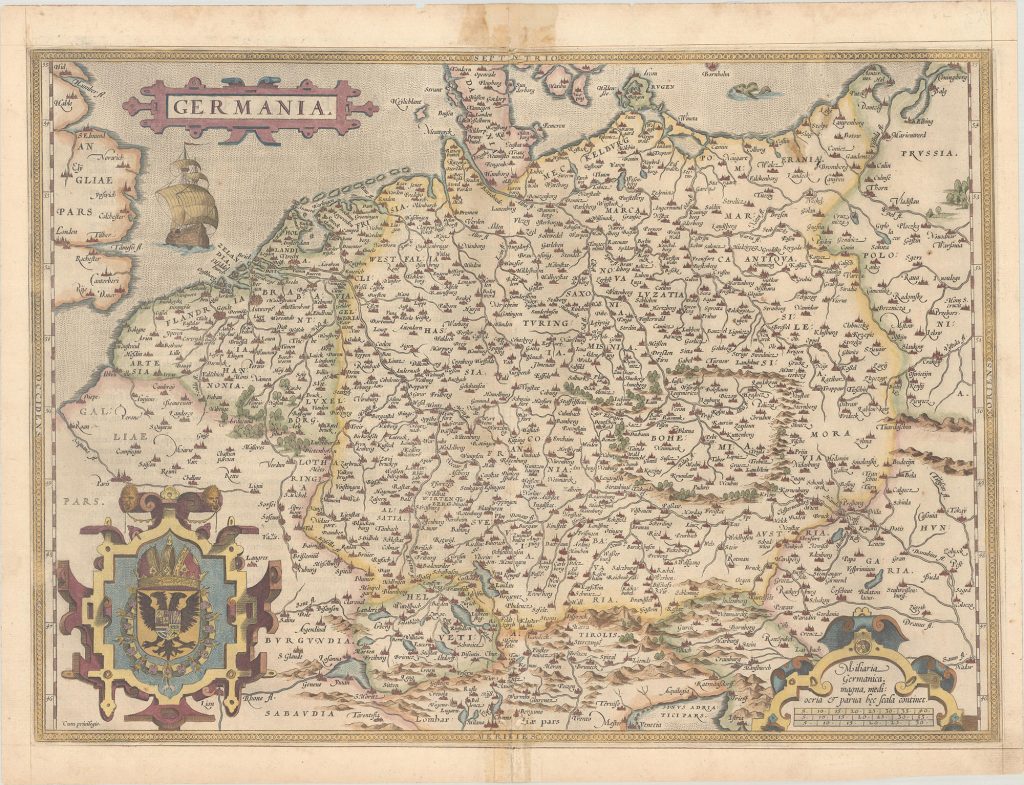
An elegant map of the German Empire which, at the time, included the Netherlands and Belgium tretching from Calais to the Wista River in present day Poland, and south to the Adriatic Sea.Ortelius based this beautiful map on Christian Sgrothen’s map of 1565. The strapwork cartouche, below to the right, with a large ship and two large cartouches that incorporate the royal coat of arms and a scale of miles to the left bottom. French text on verso, published 1572-1574. Printed on heavy paper, it is rated Excellent (see our rating criteria on the Home Page) no apparent flaws were seen. The map measures approximately (19.9 x 14.3″ -50.5 x 36.3 cm)
($12.00 shipping / handling / ins. - foreign postage addnl.)