520.23 - Carte Geographique de France avec des Remarques Curieuses sur l’Ancienne et la Nouvelle Geographie, ca 1720, by Henry Abraham Chatelain, Paris
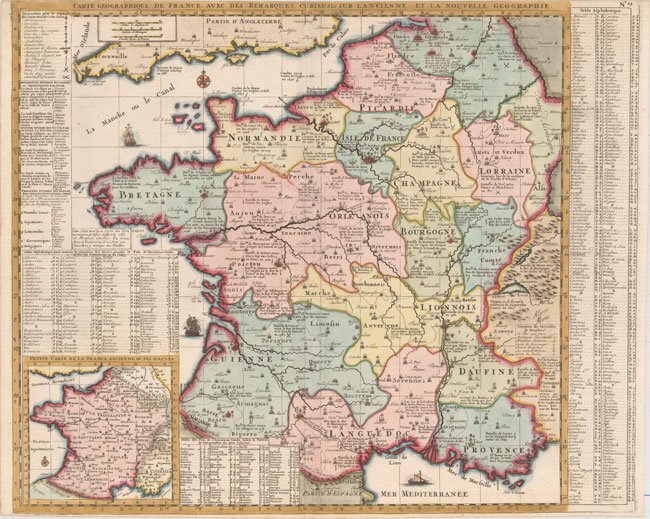
This beautifully engraved map of France shows the country divided into 16 provinces. A legend at top left identifies parliaments, universities, miliary facilities, Roman antiquities, and the locations of battles won and lost by the French. The map includes a numbered key down the right side that includes the seven Wonders of Dauphine. There is a small inset map at the lower left side corner that depicts Ancient France, with a table just above, listing various peoples according to Cesar. In all, a very informative map of its time; with attractive color denoting the political divisions. Taken from the Atlas Historique et Methodique, it is rated Very Good [see our rating criteria on the Home Page] with a good and sharp impression and borders trimmed close to the neatline.