520.31 - Hydrographicia Germaniae qua Geographiae Naturalis..., 1716, by J. B. Homann & Heirs, Nuremberg
$390.00 -
SALE PRICE $200
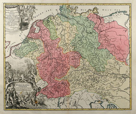
The map shows the river system of Germany and its neighboring areas. Taken form the Grosser Atlas, the map has two very detailed cartouche embellishments and shows a portion of the North Sea. It’s condition is rated Very Good [see our rating criteria on the Home Page] with only two small wax spots noted in the lower cartouche and printed on heavy paper. The map measures approximately (19.1″ x 22.8″ – 48.5 x 57.8 cm)
($12.00 shipping / handling / ins. - foreign postage addnl.)