520.32 - Carte du Government Militare d’Angleterre ou l’on Represente l’Etat des Officers de Guerre et Celui des Forces de Terre et de Mer, 1708, by Henry Adraham Chatelain, London
$210.00 -
(Zoom image – Hover slowly over image to see detail)
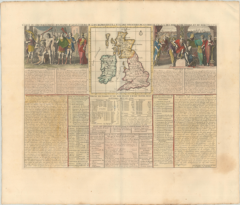
An interesting map of the British Iles to include two allegorical scenes representing British military and government , separated into land forces on the left and naval forces on the right. The French text below expounds on English military strength in the year 1704. The print is rated Excellent [see our criteria on the Home Page]. The map measures approximately (6.0” x 6.5”).
($13.00 shipping / handling / ins. - foreign postage addnl.)