520.35 - Galliae Veteris Typus, 1618, by Abraham Ortelius, Antwerp
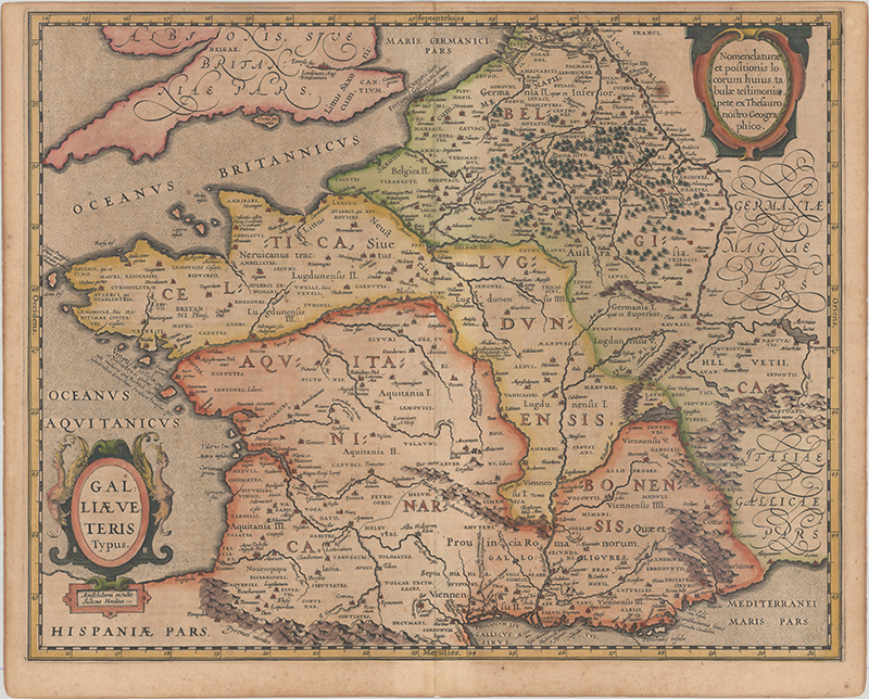
A beautiful 17th century map of France during the Roman times based on ancient geographical sources including Strabo, Plinius, Virgilius, Ovidius and Caesar; taken from the Theatrum Geographiae Veteris. Ortelius also is noted with the Theatrum Orbis Terrarum ( 53 folio sheets comprised of 70 maps engraved by Frans Hogenberg). This offering is filled with detail and ancient place names. Two ships are featured in the stipple engraved oceans and the map has two fine cartouches. This is the second edition; with Marseille now appearing as Massilla rather than Marsilia and Sequani, being added northwest of the Jura mountain range. Latin text on the verso. The print is rated Excellent [see our rating criteria on the Home Page] with a small paper flaw adjacent to the cartouche at top right. Some light toning / foxing noted. The map measures approximately (19.4” x 15.5” – 49.3 x 394. cm).