520.38 - Insula Sacra; Vulgo Holy lland; et Farne, by Johannes Blaeu, ca 1660, Amsterdam
$275.00
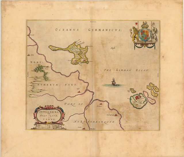
An interesting map by Blaeu of the British Islands of Holy and Farne off the coast of Northumberland. Farne Island is shown with the Tower in a fortification. On Holy Island there is depicted the Old Fort, an abbey and the King’s Bridge. Most of the mainland of the island shows only a few cities and castle symbolization. A very nice strapwork title cartouche showing the Royal Coat of Arms in original color. Spanish text on the verso. The map has very wide boarder and is rated Very Good, with some age toning noted and repair at the bottom left corner, not affecting the map. The map measures approximately (18.3″ x 15.3″ – 46.5 x 38.9 cm).
($12.00 shipping / handling / ins. - foreign postage addnl.)