520.43 - Orleans, France, ca 1643, by unknown
$97.00
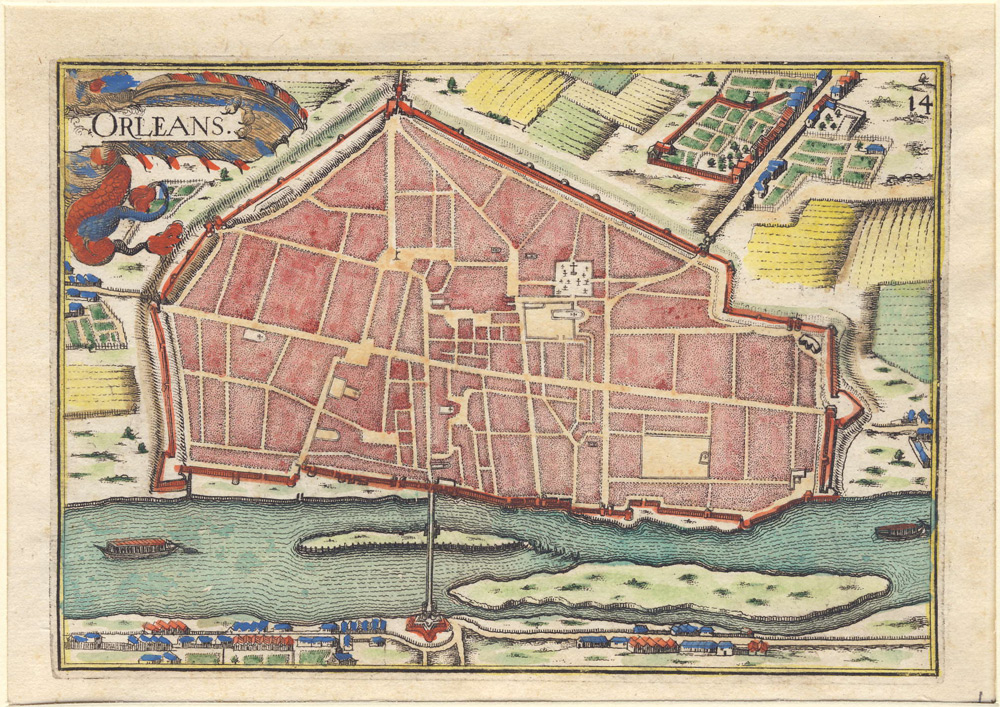
This small map from the 17th century was taken from an unknown publication. The map depicts the City of Orleans, France. Europe’s “30 year war” encompassed most of the region. Initially the war was between Protestant and Catholic states. It gradually developed into a more general conflict. Printed on laid , watermark paper, the map has been hand-colored from a copperplate impression. The street pattern is shown as well as a bridge crossing the Loire River. The hand-coloring shows very detailed features that include farmlands, houses and two barges moving along the river. The print is rated Excellent with no apparent flaws [see our rating criteria on the Home Page]. It measures approximately (7.5″ x 5.7″ – 19.3 x 15.0 cm).
($8.50 shipping / handling / ins. - foreign postage addnl.)