700.13 - A Correct Draught of the North Pole and of All the Countries Hitherto Discovered, Intercepted Between the Pole and the Parallel of 50 Degrees.., ca 1748, by Emanuel Bowen, London
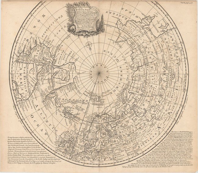
A very detailed map that shows the tracks of navigators in their numerous attempts to find a northern passage to the economic wealth of Aisla. The map depicts with track lines, the various routes with detailed information on their hunt for the Northwest Passage, via the Hudson River. Of note, much of Greenland and the western part of North America remain undiscovered. The map has a decorative title cartouche at the center top. Interesting text is a the bottom left and right of the map describing the explorations of finding a Northwest Passage. The map forms a very historical document to that time including the exploits of the 1746 Arthur Dobbs expedition. It is rated Very Good [see our rating criteria on the Home Page] printed on watermarked paper with some light offsetting noted. The map measures approximately (16.6″ x 15.4″ – 42.2 x 39.2 cm).