800.07 - Barbariae et Biledulgerid, Nova Descriptio, 1595, by Abraham Ortelius, Antwerp
$325.00 -
(Zoom image – Hover slowly over image to see detail)
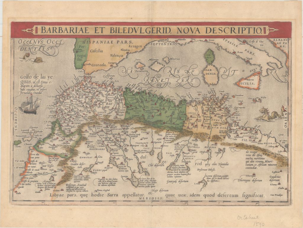
A beautiful and detailed map of the Barbary coast based on Gastaldi’s Africa. The map extends from Morocco to Libya on the western Mediterranean depicting the location of the Balearic islands, Corsica, Sardinia, southern Italy and Sicily. The title is contained in a strapwork panel across the top. Typical of that time period, there are two sea monsters and a masthead image this very interesting offering. The map is rated Excellent [see our rating criteria on the Home Page] with a dark image in full color and only minor foxing noted to blank areas of the margin. It measures approximately (19.8″ x 13.0″ 50.3 x 33.1 cm).
($12.00 shipping / handling / ins. - foreign postage addnl.)