800.08 - Wahrhaffte Abbildung der Barbarischen Vesting ORAN mit der Beyliegenden, ca 1732, by Homann Heirs, Nuremberg
$285.00
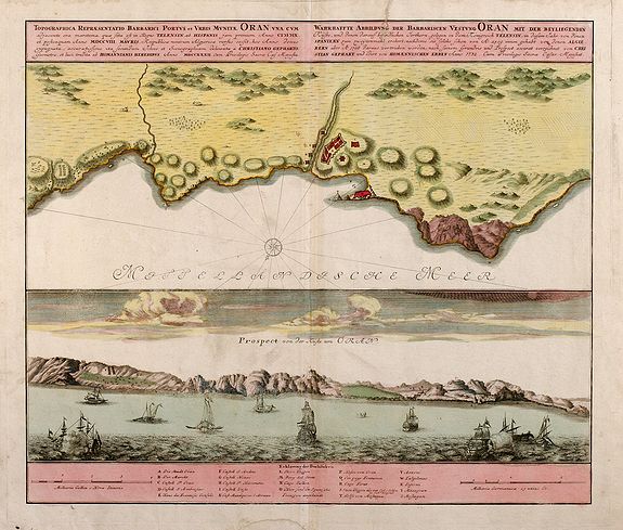
The top portion is a detailed 18th century map of Algeria (Oran Province) with Algeria noted and shaded relief features shown of the coast of the Mediterranean Sea. The bottom half of the map is a view of the harbor with masted ships and fishing vessels depicted. A list of prominent topographic features is provided along with a distance scale. The map, in original wash color, is rated Very Good [see our rating criteria on the Home Page] with one repaired tear noted at the top left center margin protruding into the neatline by 1 cm. The map measures approximately (18.0″ x 21.5″ – 46 x 54 cm).
($12.00 shipping / handling / ins. - foreign postage addnl.)