800.17 - Oran Munita Urbs et Comodus Port in Ora Maritima Barbariae et Proprie in Regno Telensin .., ca 1740, by Matthias Seutter, Augsburg
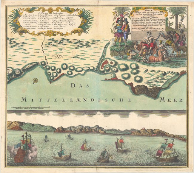
This splendid visual presentation typifies the style and format of a series of birds-eye-views and panoramic depictions of major cities and ports published in Germany during the eighteenth century. At the top is a map of the coastline showing the fortifications of the Algerian port of Oran with Algeria noted in shaded relief. At the bottom is a coastal view with a fleet of masted ships approaching the coast. The print is beautifully embellished with a large allegorical; title cartouche featuring Zeus and surrounded by indigenous natives and European adventurers. See also map 800.08 with a similar view. The print is hand colored, rated Excellent (see our rating criteria on the Home Page) with a dark impression and three short tears at the papers edge at the bottom, repaired on the verso with archival materials. It measures approximately ( 21.5″ x 19.1″ – 54.7 X 48.6 cm)