800.27 - St. Petersburg, Russia, 1834, by SDUK - Society for the Diffusion of Useful Knowledge, London
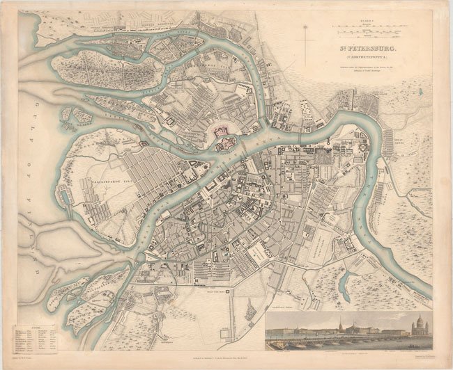
A very detailed plan of the city of St. Petersburg, Russia. Centered on the Peter and Paul Fortress, and located on the Zayachii Ostrov, Neva River. Good place name features include most major buildings, streets, and waterways. A large panoramic view shows the city from across the Neva River with the Isakiefskoi Bridge noted as well as the Winter Palace. The map was drawn by W. B. Clarke and engraved by B. R. Davies; published by Baldwin & Craddock. The SDUK was formed in 1828 by Lord Brougham and a group dedicated to the education of the aspiring working class. The map is rated Very Good [see our rating criteria on the Home Page] with some light soiling noted; in original color with later color added to the vignette of the city scape. It measures approximately ( 15.3″ x 12.5″ – 38.9 x 31.8 cm).