800.78 - “Geographische Beschryvinge, van de Wandeling der Apostelen Ende de Reysen Pauli .....”, 1647, by Jacob Savry, Amsterdam
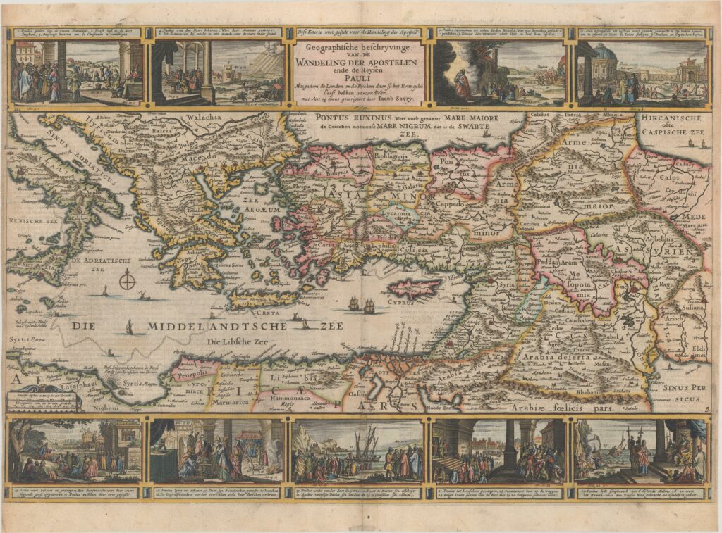
The map portrays the Eastern Mediterranean from Rome, through Asia Minor and the Holy Lands, to Babylon. The political divisions shown in color, depict the conditions of the first century A.D. Savry produced four maps all of Palestine and the Near East with this map is most notable issue, used in Dutch bibles. The panels at the top of the map show the major events of Paul’s journey; each vignette being a composite of two or three episodes. Of the many depictions, the one of young Paul before his conversion, healing the paralytic, his ship wreck at Malta, and his appearance before Nero are the most compelling images. There is Dutch text on the verso. The map is rated Excellent [see our rating criteria on the Home page], a dark impression on a sheet with a sun watermark and some light soiling noted as well a narrow side margins; as issued. It measures approximately (18.9″ x 12.9″ – 48.0 x 32.8 cm).