801.14 - World Island - A Fortune Map Orthographic Series, III, 1943, by Fortune Magazine, Richard Edes Harrison, New York
$160.00
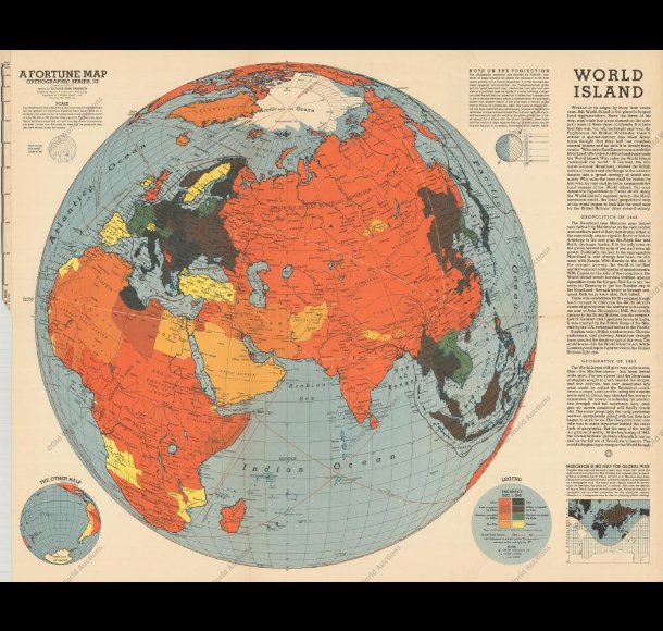
The map focuses on the largest “world island”, looking at the world continents of Europe, Asia, and Africa during World War II. It is color – coded to depict the balance of power between Allied and Axis countries. There is an insert map at the bottom right showing the “other half” as well as text concerning the war. The map is rated Excellent with only fold marks as issued and several archival repairs along the sheet edges [see our rating criteria on the Home Page]. It measures approximately (26.0″ x 20.04″ ).
($12.00 shipping / handling / ins. - foreign postage addnl.)