Age of Exploration
Rare Old & Antique Maps for Sale.
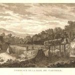
22.03 - Tombeaux de la Baie de Castries, c1797, by Jean-Francois Galoup (Comte La Perouse), Paris
This is a copperplate engraving of the French scientific expedition commanded by Jean-Francois de Galaup to the Pacific in 1785-88. Recognized as one of Frances’ foremost naval officers, he was…
Read More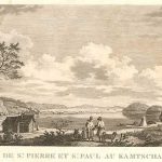
Copperplate engraving of the French expedition to the Pacific under the command of Jean-Francois de Galoup in 1785-88. A view of the village and natives of St. Paul at Kamchatka. …
Read More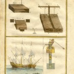
The page was taken from Diderot’s Encyclopedie . Engraved by Laurent, this was a very important work as it gave an inventory of 18th century science and craftsmanship just before…
Read More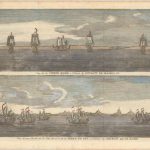
This print shows two views from George Anson’s voyage through the Strait of Magellan and the Le Maire Strait. In 1740 Anson set sail commanding a squadron sent to attack…
Read More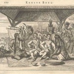
In 1670 John Ogilby published his America, based on the work published by Arnoldus Montanus. This publication offered the most complete cartographic record to date of both North and South…
Read More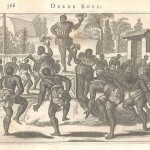
From the 1670 edition of John Ogilby’s America, the image is based on the work of Arnoldus Montanus. The publication offered the most complete cartographic records to date of North…
Read More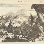
From the 1670 edition of John Ogilby’s America, the image is based on the work of Arnoldus Montanus. The publication offered the most complete cartographic record to date of North…
Read More
In 1670 John Ogilby published his America, based on the work published by Arnoldus Montanus. This publication offered the most complete cartographic and illustrated record to date of the Americas….
Read More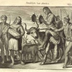
Another work from John Ogilby’s 1670 publication America, based on the work of Montanus. This original print from the publication depicts a scared cow being lead by a native and…
Read More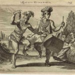
An interesting print from John Ogilby’s 1670 publication America. The original print from the publication depicts natives dancing with their ornamental garb. The print is rated Very Good with Dutch…
Read More