WORLD WAR II – Memorabilia – Nazi Germany / USSR / United States
Rare Old & Antique Maps for Sale.
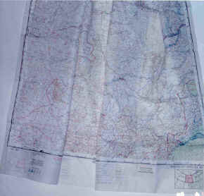 82.00 ‘Silk Maps’, c1944 – 1952, Army Air Force / USAF
Escape and Evasion Cloth Maps
Most maps today are printed on good quality paper, but there were maps produced on cloth (or, textile cartography) dating back many centuries. The fabric map technique dates from the Han dynasty. In 1973-74 excavations near Mawangdui, in the province of Ch’ang-sha, China produced three maps drawn on silk. After careful restoration, it became clear that one of these maps (now known as the Garrison Map), had been prepared by cartographers to the king of Ch’ang-sha, whose kingdom was made up of modern Hunan and that the map was for military use sometime around 168 BC. The maps we offer were first introduced by the British during World War II. The first maps during WWII were issued by M19 and based on existing maps of John Bartholomew, one of England’s most prominent map-makers. In addition to the British, the Australians and the United States began production of cloth maps. The Army Air Force (AAF) through the efforts of there Aeronautical Chart Service produced a series of the cloth maps on printed on rayon. From this came the term ‘silk maps’. One of the military uses of the silk (cloth) maps was to have them included in the survival kits of allied pilots. There durability and foldability were ideal for downed pilots in enemy territory, for escape and evasion needs [the kits were known as Escape & Evasion Survival Kits]. After WWII the cloth ‘silk maps’ continued to be used as the Cold War escalated. Soon after WW II ended, the U.S. Air Force was formed and under their Aeronautical Chart Service the cloth maps continued until the early 1950’s as part of the Cold War effort. The story of the WWII cloth (silk maps) has been difficult to piece together because of the manner in which they were developed and their production was shrouded in secrecy during and after the war. The collection we offer of these unique examples of mapping differ slightly in size. All are printed on both sides with adjoining sections. We also have a number of WW II maps listed below that are very rare and, in some case, were used by agents of the British intelligence service. The following list of cloth maps indicates ones still available: $60. each – except where noted, (shipping / handling / insurance $9.00) per order.
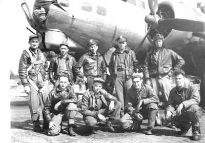
B-17 crew of the 398th Bomb Group, 8th Army Air Force (AAF) in England during World War II. Lt. Wallace Blackwell, co-pilot is seen standing, back row second from right.
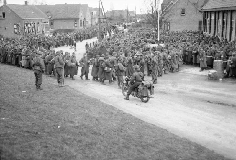
The surrender of some 40,000 German soldiers in 1945 in Belgium.
Prior to the 3rd Reich and Nazi Germany, the National Forestry Service controlled the vast lands of Germany’s many forests. During the 3rd Reich, Hermann Goring was made head of…
Read More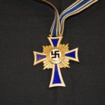
The Mother’s Cross was first used in WW I as the war took a heavy toll on German men. As Nazi Germany began to evolve, Hitler took steps to insure…
Read More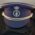
The hat is worn by the Belgium security forces throughout the country. It bears the Royal Crown of Belgium and signifies their security symbol. The hat is new and indicates…
Read More
801.106 - Central Europe , World War II Newspaper, 1944, by New York Journal- American, New York
The newspaper New York Journal American in September 23, 1944 published on the back page map titled “Plan for Peaceful Germany Must Strip Prussia of Power”. The map shows a…
Read More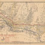
A very detailed map of the city that was issued in 1944 to show “two-way traffic, emergency routes, and alternate routes”. Off-limit areas, which were subsequently added to the printed…
Read More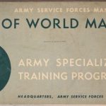
The Army Services Forces Manual (M-101) was specifically prepared for the use in the study of geography as part of the Army Specialized Training Program during WWII. There is 13…
Read More
The rise of Adolf Hitler and the formation of the Nazi Party after WWI; brought about the Third Reich. Every aspect of German life was flooded with Hitler’s image and…
Read More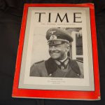
A fascinating look back at Nazi Germany at a time when the United States was still neutral. Featured on the Time cover is Field Marshal Walther von Brauchitsch who commanded…
Read More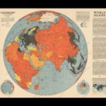
The map focuses on the largest “world island”, looking at the world continents of Europe, Asia, and Africa during World War II. It is color – coded to depict the…
Read More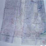
Published by the Army Air Force (AAF), Washington, D. C. , 1944, scale 1:1,000,000; (23″ x 26″).
Read More