Antique Maps for Sale
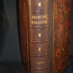
Profusely illustrated, published by T.S. Arthur & Co., pp374 + 28 illustrations (many in color). The book covers the period from January to June 1856 with every imaginable subject from…
Read More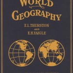
Numerous maps, some in color, graphs and tables. Dr. Thurston was the Superintendent of the Washington , D.C. schools and Professor Faigle was at Syracuse University, Geography Dept. The book…
Read More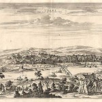
30.30 - Terki, Ville de la Circassie, dans l' Asie (Asia), c1719, by Pieter Vander Aa, Leiden
A very detailed panoramic view of Terki, the capital of one of the most powerful Dagestani potentates of southeast Asia. The print is filled with villagers in their daily lives. …
Read More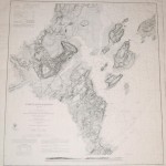
The first published nautical chart by the Survey of the Coast (U.S. Coast Survey) to include both hydrographic and topographic information. In addition to the soundings in the harbor there…
Read More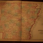
A very detailed geographic double-page map with county outlines in pastel color. Roads, place names and topographic features are named. The map is rated Very Good with no apparent flaws…
Read More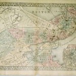
This is the large plan of the city by Mitchell from his Atlas of the World. The map shows the districts by number an pastel color and includes an insert…
Read More
In 1863 Alvin J. Johnson and Benjamin P. Ward formed the next generation of the Johnson mapping business. Ward was an agent for the Johnson company and when Johnson’s former…
Read More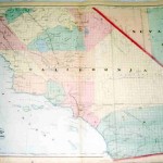
The map covers California from Santa Cruz and the Monterey Bay south to San Diego and east to the western portions of Nevada. The map is from the New Commercial,…
Read More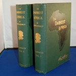
This is the two volume, 529pp & 472pp 1st American edition set, signed by the author, limited to 250 copies. The story of Henry Morton Stanley and Dr. Livingstone is…
Read More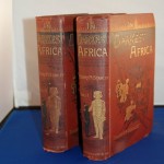
The publication discusses Stanley’s last African expedition. There are 50 woodcut illustrations, 3 foldout maps, 8 vo, original pictorial gilt, 529pp – 472pp. There are two woodcut frontispiece illustrations ………..
Read More