Antique Maps for Sale
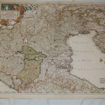
The map encompasses all of northern Italy and includes the Gulf of Venice. In original outline color, the map has an elaborate title cartouche with putti within the border and…
Read More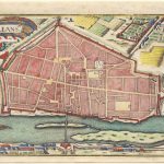
This small map from the 17th century was taken from an unknown publication. The map depicts the City of Orleans, France. Europe’s “30 year war” encompassed most of the region. …
Read More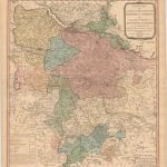
One of the classic maps produced by Jefferys during the 18th century. Appointed Geographer to the Prince of Wales; in 1760 became Geographer to the King. In the early 1760’s…
Read More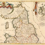
Father Coronelli, cosmographer to the Republic of Italy, globe-maker, and publisher; produced 400 maps to include this very beautifully engraved map of England and Wales. The map is in two…
Read More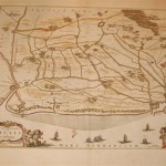
An attractive map of the northwestern sections of France including the towns of Calais and Gravelines. Two elaborate title cartouches embellish the map with sailing ships in the coastal waters….
Read More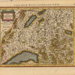
This is the reduced version of Mercator map of southwest Switzerland, showing Geneva, Lake Geneva, Lake Biel, Bern, Freiburg and Lake Thuner among others. From the Atlas Minor map is…
Read More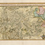
A beautiful copperplate engraving of Switzerland, featuring the Lorraine region. The map is full of the locations of numerous small villages. An interesting title cartouche is located in the right…
Read More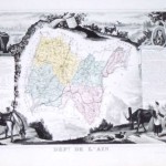
The map includes part of the French Alps. The city of Bourg is near the center. The production of cheese, in including Bleu de Gex is a leading product of…
Read More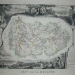
The map depicts the region of France that produces fine Gruyere cheeses. Includes scenic areas of the Alps. Condition is Very Good [see rating criteria – Home Page].
Read More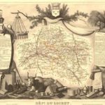
A very detailed map of this French region with representation of the framing and indigenous animals as well as textual data.
Read More